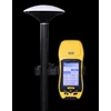
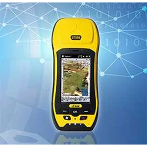
Detail GIS COLLECTOR CHC LT500 SERIES
The LT500 series is a rugged, versatile GNSS handheld receiver, that
LT500N/ LT500T/ LT500H covers three accuracy ranges from sub meter to
centimeter accuracy and is the most cost effective positioning solution for
Survey, Construction and GIS professionals.
L T500H L1/ L2 GPS+ GLONASS, L1 BDS, L1 Galileo Tracking
The LT500H addresses a centimeter level position accuracy utilizing the
internal cellular modem to access a local reference station network und er
RTK working mode.
LT500T L1 GPS+ GLONASS+ BDS+ Galileo
The LT500T is designed to work in the projects requiring the decimeter
accuracy, in the application as utilities, underground pipelines and land
records management when high accuracy is required.
LT500N L1 GPS
Embedded with professional GPS engine, the LT500N prepares the
user to capture sub meter data with SBAS differential correction signals
or DGPS correction information from the local reference station.
LT 500 H
Channel: 120
Satellite Signal : GPS L1, L2; Glonass L1, L2, Beidou B1, Galileo E1
Update Rate : 1Hz or higher
Protocols : RTCM2.x/ RTCM3.x/ RTCA/ CMR/ CMR+ / NMEA0183
Standalone GPS : 1.2 m
Realtime Correction : 1cm
With SBAS : 50cm
Post Processing Static:
Horizontal: 5mm ± 1ppm
Vertical: 10 mm ± 1 ppm
LT 500 T
Channel: 220
Satellite Signal : GPS L1; Glonass L1, Beidou B1, Galileo E1
Update Rate : 1Hz or higher
Protocols : RTCM2.x/ RTCM3.x/ RTCA/ CMR/ CMR+ / NMEA0183
Standalone GPS : 2 m
Realtime Correction : 25cm
With SBAS : 50cm
Post Processing Static:
Horizontal: 5mm ± 1ppm
Vertical: 10 mm ± 1 ppm
LT 500 N
Channel: 12
Satellite Signal : GPS L1
Update Rate : 1Hz or higher
Protocols : RTCM2.x/ NMEA0183
Standalone GPS : 2.5 m
Realtime Correction : 60cm
With SBAS : 50cm
Post Processing Static:
Horizontal: 5mm ± 1ppm
Vertical: 10 mm ± 1 ppm
Tampilkan Lebih Banyak